
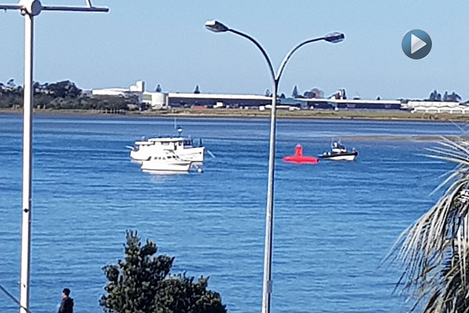
The mysteries of the deep – or at least Tauranga Harbour – have been revealed.
A red submarine looking vessel spotted in the harbour on Monday has sparked a lot of intrigue from the public.
The craft has been identified as not a submarine, as some people thought it might have been, but rather a piece of survey equipment – called iXblue DRIX- that belongs to Pacific 7. Pacific 7 are one of the lot owners at Vessel Works, says a Bay of Plenty Regional Council communications advisor.
The iXblue DRIX now calls Tauranga its home port.
The DriX was designed and built in France with 21st century characteristics in mind.
The purpose of the unmanned vessel is to go places too hazardous for humans and to carry out work at a fraction of the cost of a manned vessel.
It was also designed to be extremely seaworthy and stable, as its key function is to gather high-resolution data of the seafloor meant for navigational charting and safety.
With a hull length of 7.7 m and less than one meter wide, this vessel tracks like a racing yacht at speeds of up to 14 knots.
Being unmanned and without a cabin, the DriX is ultra-streamlined, making it very fuel efficient.
Its 250-litre fuel tank gives it a 4-5 day, round-the-clock endurance at survey speed, or up to seven days at slower pace.
Project manager Rhys Davis says they currently have onsite engineers that have travelled from their French Shipyard, who designed and built the vessel to undertake the re-integration, which includes a period of sea acceptance trials within the Tauranga Harbour Area.
The vessel can operate in fully autonomous, semi-autonomous or direct remote control.
Survey lines can be pre-programmed, or updated on the fly, and the DriX will systematically progress the survey area, starting and stopping lines or conducting tasks as required. Responsive steering and manoeuvrability allows the DriX to manoeuvre between survey lines in less than one-minute, including motion stabilisation.
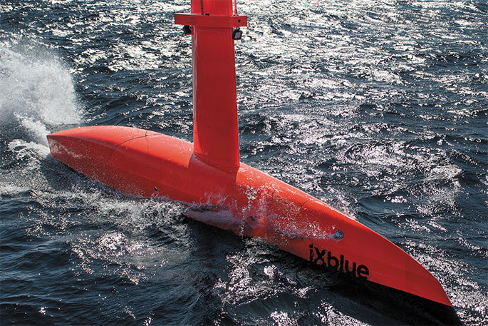
Equipped with a Velodyne LiDAR, AIS, optical and infra-red cameras the ‘eyes’ of the Drix are transmitted in real-time back to the support vessel for the DriX Pilot to monitor collision avoidance an initiate a manual override as required.
The DriX is heading to Tonga in November for its maiden mission.
Land Information New Zealand and Ministry of Foreign Affairs and Trade are funding an extensive survey of the island chain to update charts which will significantly enhance navigational safety for mariners.
0 Comments
Leave a Comment